Kyotango Geotrail

Conquer all courses!Kyotango Geotrail Program

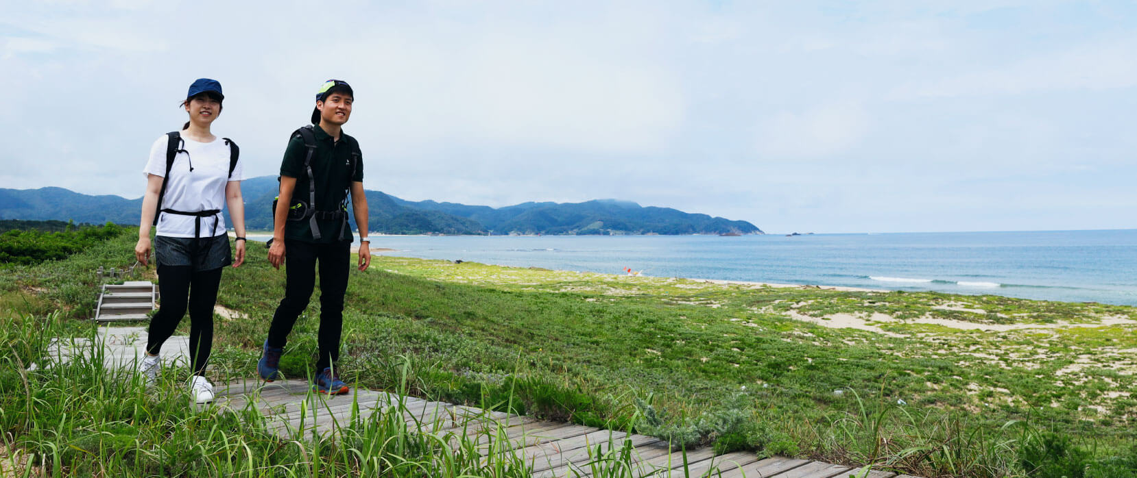
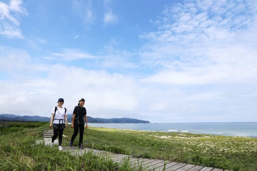
The Kyotango Geotrail program is an approximately 80 km long trail consisting of 8 walking courses which traverse the Kyotango area of the San’in Kaigan UNESCO Global Geopark from Tango-cho to Kumihama-cho (east to west). Kyotango is one of the few places in Japan where you can walk such a long distance trail using mostly natural paths along the coastline.
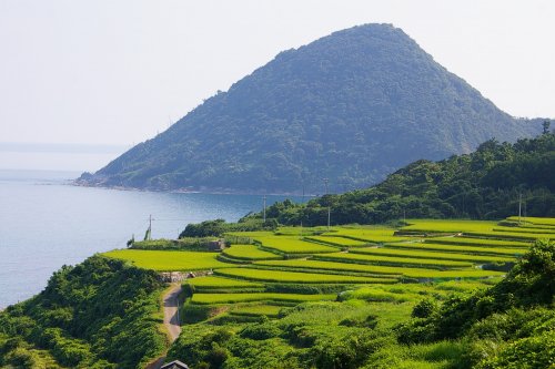
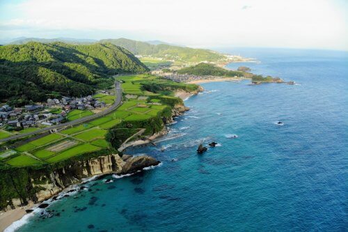
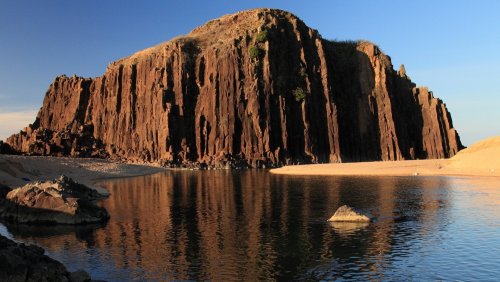
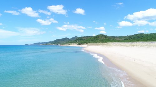
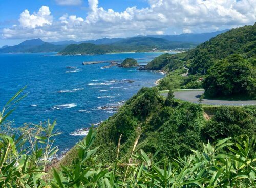
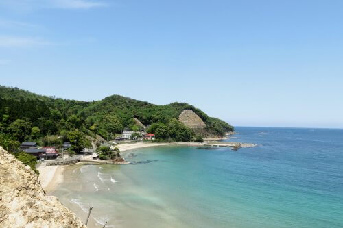
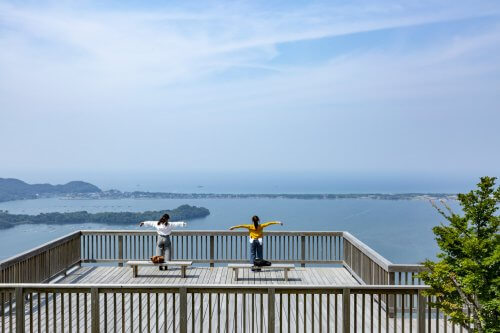
On the trail you can discover the untouched nature along the coast of the Sea of Japan from the expansive natural scenery of the Geopark to the landscape, history and culture of local fishing villages. From the pristine sands and craggy rocks of the coast, to the sand dunes and mountain trails further inland, there are various terrains to journey through.

Attention to Geotrail Users

The Kyotango Geotrail program passes through the San’in Kaigan National Park, which is part of the San’in Kaigan UNESCO Global Geopark.
We request that you abide by the following rules when partaking in our walking courses.

  1. 1. Treat the nature with care
  2. 2. Take your rubbish home with you
  3. 3. Use the available toilet facilities
  4. 4. Be considerate of the locals and other tourists and hikers
  1. 5. Stay informed about trail conditions ahead of time and avoid trekking beyond your limits
  2. 6. Follow the rules and regulations of each region
  3. 7. Stay overnight in the designated accommodation
  4. 8. Take care not to damage any relics or cultural assets
Guiding Arrangements

Guiding offered by Local Guides is available.
Pricing varies depending on number of people and duration. Those interested in guiding arrangements are encouraged to get in touch.

  • Course1
    Tango

    Kyogamisaki to Ukawa Onsen Course

    Time Required: About 290 mins
    Distance: Approx.10 km
    Difference in Elevation: Approx. 150 m
    Details
  • Course2
    Tango

    Ukawa to Onaru Burial Mounds Course

    Time Required: 260 mins
    Distance: Approx. 12 km
    Difference in Elevation: Approx.150 m
    Details
  • Course3
    Tango

    Tateiwa Rock to Mitsu Course

    Time Required: 240 mins
    Distance: Approx. 8.6 km
    Difference in Elevation: Approx 50 m
    Details
  • Course4
    Amino

    Mitsu to Asamogawa Course

    Time Required: 260 mins
    Distance: Approx. 8.4 km
    Difference in Elevation: Approx. 50 m
    Details
  • Course5
    Amino

    Asamogawa to Yuhigaura Course

    Time Required: 300 mins
    Distance: Approx. 12.2 km
    Difference in Elevation: Approx. 160 m
    Details
  • Course6
    Kumihama

    Yuhigaura to Shotenkyo Course

    Time Required: About 240 mins
    Distance: Approx. 8.7 km
    Difference in Elevation: Approx. 20 m
    Details
  • Course7
    Kumihama

    Shotenkyo to Kamai Beach & Asahi Fishing Port Course

    Time Required: About 255 mins
    Distance: Approx. 8.8 km
    Difference in Elevation: Approx. 110 m
    Details
  • Course8
    Kumihama

    Kumihama to Shotenkyo Course

    Time Duration: About 290 mins
    Distance: Approx. 12.3 km
    Difference in Evelation: Approx. 190 m
    Details